


Now Reading: IIT Bombay Unveils AI to Interpret Satellite Images via Natural Language
-
01
IIT Bombay Unveils AI to Interpret Satellite Images via Natural Language
rapid Summary:
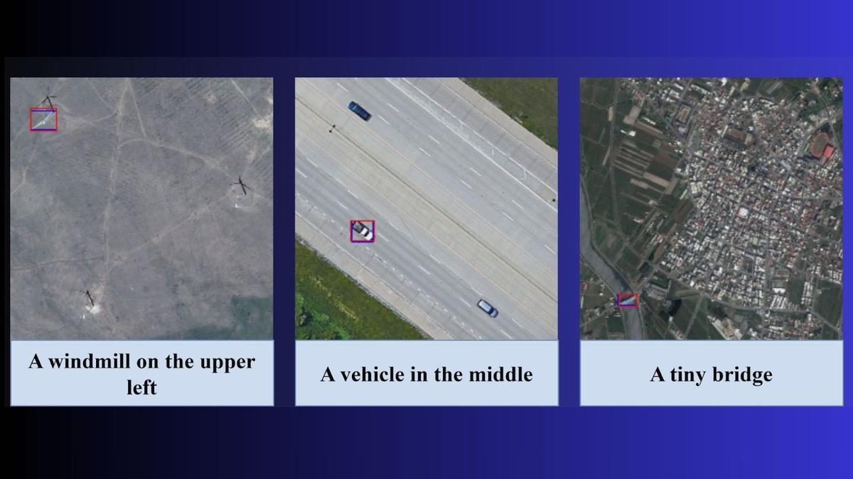
- Researchers at IIT Bombay have developed an AI model, Adaptive Modality-guided Visual Grounding (AMVG), to interpret satellite and drone images using natural language prompts.
- AMVG enables targeted image analysis for scenarios like disaster response,surveillance,urban planning,and agriculture. Users can input commands like “find all damaged buildings near the flooded river” to obtain detailed results within minutes.
- The model introduces features such as a Multi-stage Tokenised Encoder and Attention Alignment Loss (AAL), enhancing contextual understanding and accuracy.
- Potential applications include locating damaged infrastructure after disasters, identifying camouflaged vehicles in security zones, or monitoring crop health through simple queries.
- AMVG outperforms existing alternatives but has not yet been tested in real-world scenarios due to the absence of relevant datasets. Future plans involve creating such datasets for disaster management evaluation.
- Collaboration with ISRO is anticipated to integrate AMVG into operational areas. The team has also open-sourced its implementation on GitHub to promote transparency across remote sensing research.
- Limitations include dependence on high-quality annotated data and challenges in optimizing performance for real-time use.Further work aims to adapt the model across diverse environments.
Indian Opinion Analysis:
The advancement of AMVG signals significant progress in leveraging AI-driven solutions for complex image interpretation tasks essential in critical areas like disaster management, national security, agriculture monitoring, and urban planning.Its ability to contextualize satellite imagery using everyday language simplifies operations previously confined within highly technical domains.
While promising results from initial tests highlight potential breakthroughs in speed and accessibility of remote sensing analysis tools, the lack of real-world evaluations presents an obstacle that requires attention before widespread applicability can be established-a concern acknowledged by researchers themselves. Collaborations with institutions like ISRO could enhance scalability while fostering innovation tailored toward India’s unique ecological challenges.
Notable steps such as open-sourcing show commendable commitment toward accelerating advancements through collective effort by bridging gaps between academia and practical application frameworks globally-offering vast implications not only for India but also internationally within this rapidly evolving field.


Related Posts
Stay Informed With the Latest & Most Important News
Previous Post
Next Post


Advertisement